300,000 Sq.Ft. of Scan to CAD Conversion in Just 8 Days
Project Overview
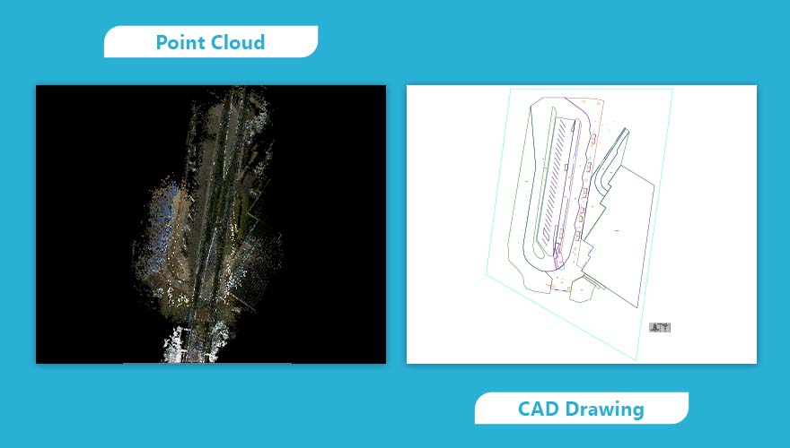
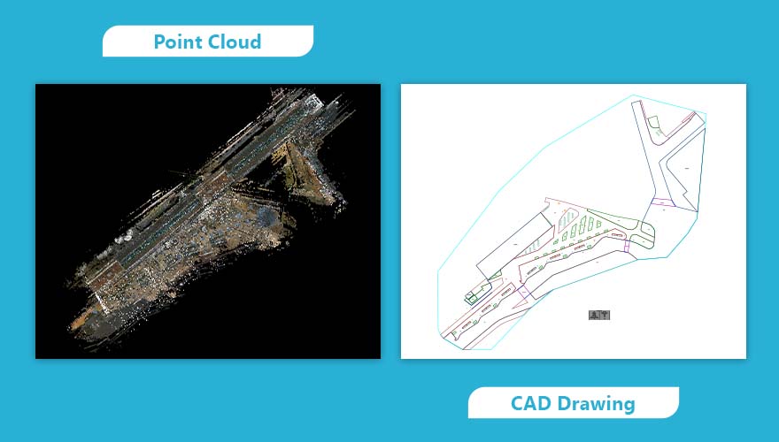
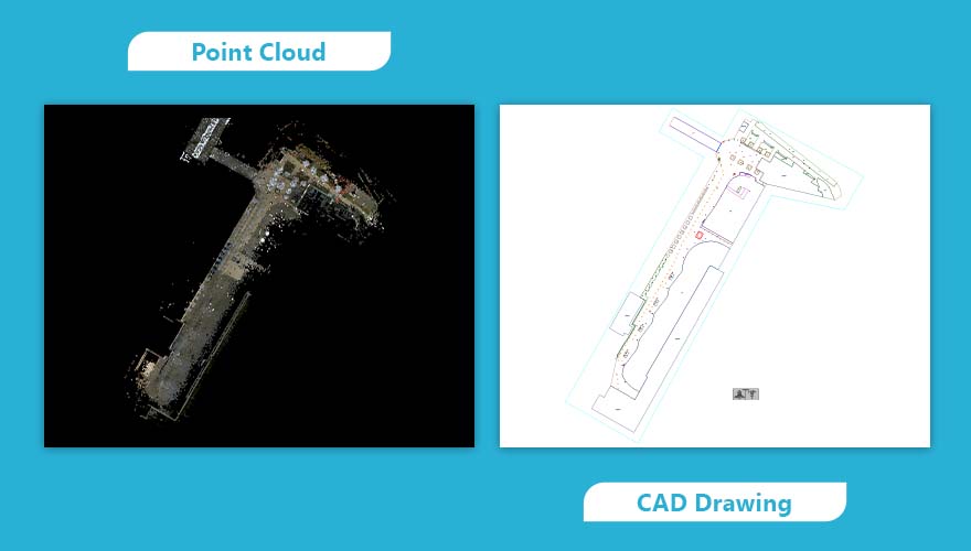
In just 8 days, a USA public infrastructure project achieved a significant feat: converting 300,000 square feet of scans into CAD drawings. Despite facing hurdles like low-quality data and limited image resources, the project overcame challenges with inclined scans and registration issues. Thanks to smart use of in-house AI and quality checks, they kept human involvement low while maintaining top-notch quality throughout.
Project Details

Location
USA

Type of Building
Public Infrastructure

LOD
300

Discipline
MEPF Model

Software
AutoCAD
Are you looking for Scan to BIM services with the fastest speed and accuracy?
Start your 1st Pilot Project @ $10/Hr.GET IN TOUCH
SCHEDULE A MEETING
Contact Us
Let’s discuss your requirements and see how our expertise can help
on your next project.
We provide the fastest Scan-to-BIM conversion in the States, leveraging AI to deliver unmatched quality and speed.
©2026 ScantoBIM.Online powered by Virtual Building Studio Inc.